articles/Review/gps-page8
GPS – Finding your way to that perfect landscape location - part 8 of 1 2 3 4 5 6 7 8 9 10 11 12 13 14 15 16
by Mike McNamee Published 01/02/2017

What File Format Should I Use?
The Edge 810 can use either a GPX Track or a TCX. A TCX Course has the advantage of embedding your planned route’s cue sheet. So, alongside Garmin’s dedicated navigation, you get beeps and text for each pre-planned cue entry in the cue sheet. This is especially helpful if you have custom cue sheet entries, as well as a nice double check to Garmin’s own navigation.
The downside to a TCX file for navigation is the Virtual Partner. When we create a TCX Course file for a pre-planned route, we have to embed fake timestamps on each point, which is used for the virtual partner speed on the GPS unit. As a result, you’ll end up racing against the virtual partner.
If you load a TCX Course or a TCX History of an uploaded ride on the site (a ride that you or someone else recorded and uploaded to our site) you will get virtual partner speeds identical to the speeds actually ridden along the ride. This is helpful when riding against your previous time, or someone else’s previous time.
This could hardly be simpler so its failure to work can only be down to Garmin!

We built a route using CycleStreets.net, exported it as a .gpx file and then imported it to the Anquet Outdoor Map Navigator. It worked perfectly, making the inability of Garmin to perform the same operation even more frustrating!
MTBTrails
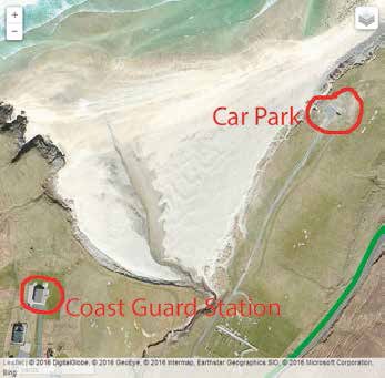
We chanced upon this website while looking for a route from Kilmarie to Camasunary in southern Skye. Once again it shows the way in which searching on Google can fail to bring up really useful information for want of search term choice. We had plotted a route on Plotaroute (making use of their snap to path facility) then saved out the file as a GPX for importing to MTBTrails as well as taking a look at Cyclethestreets so that we could use Bing Aerial to review the scenery a little (note that Plotaroute is using Google Aerial and that cloud cover is destroying the resolution). The far end of the route looked challenging on the Bing Arial view and so we searched 'bike routes Kilmarie to Camasunary then lo and behold we chanced upn MTB Trails. MTBTrails allowed us to scale the printer-to-PDF output to neatly cover the route and then output a high-quality map to PDF. MTBTrails can handle 167 different GPS file formats using an open source service called The GPS Babel project – (so here we are 18 days into this project and still making major discoveries! Ed).
Please Note:
There is more than one page for this Article.
You are currently on page 8
- GPS – Finding your way to that perfect landscape location page 1
- GPS – Finding your way to that perfect landscape location page 2
- GPS – Finding your way to that perfect landscape location page 3
- GPS – Finding your way to that perfect landscape location page 4
- GPS – Finding your way to that perfect landscape location page 5
- GPS – Finding your way to that perfect landscape location page 6
- GPS – Finding your way to that perfect landscape location page 7
- GPS – Finding your way to that perfect landscape location page 8
- GPS – Finding your way to that perfect landscape location page 9
- GPS – Finding your way to that perfect landscape location page 10
- GPS – Finding your way to that perfect landscape location page 11
- GPS – Finding your way to that perfect landscape location page 12
- GPS – Finding your way to that perfect landscape location page 13
- GPS – Finding your way to that perfect landscape location page 14
- GPS – Finding your way to that perfect landscape location page 15
- GPS – Finding your way to that perfect landscape location page 16
1st Published 01/02/2017
last update 21/07/2022 08:49:43
More Review Articles
The Society of Photographers Convention and Trade Show at The Novotel London West, Hammersmith ...
You have 0 days until The Society of Photographers Convention Wednesday 14th January 2026


