articles/Review/gps-page2
GPS – Finding your way to that perfect landscape location - part 2 of 1 2 3 4 5 6 7 8 9 10 11 12 13 14 15 16
by Mike McNamee Published 01/02/2017

But we digress – the main thrust of this feature is to explore the bits of the country which are off the satnav and, most probably, away from the prying eyes of Google Street View. We are talking landscape photography here, which often involves going up hills or down to beaches to get the shot you are after. The prime viewpoint is rarely at the side of a metalled road with a tarmac car park, and it were, your shot would simply join the other couple of hundred similar shots on Face book.
Maps are the key to finding your way and interacting with the landscape.
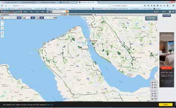
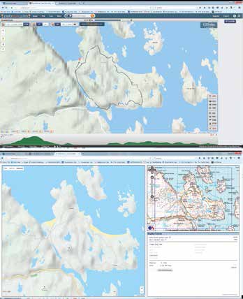
In the UK the major mapping facilities are provided by Ordnance Survey (OS), Google Maps, Bing Open Street Map (OSM) and Harvey.

OS provides the most general detail, particularly in open country and mountain regions where even individual boulders will be drawn if they are large enough. Harvey maps for walkers are finely detailed. Open Street Map is an open source mapping venture (and community) with worldwide coverage by a large number of dedicated mappers and coders. It is regularly updated and concentrates exclusively on mapping while providing its output coding to specialists such as cycle-route and walking-route planners. The recently introduced OSM Cycle is the product of this collaboration in which OSM provides the underlying skeleton map and the cycling enthusiasts have added a cycling 'layer' which details cycle-friendly roads, paths and bye ways. It is quite superb.
Please Note:
There is more than one page for this Article.
You are currently on page 2
- GPS – Finding your way to that perfect landscape location page 1
- GPS – Finding your way to that perfect landscape location page 2
- GPS – Finding your way to that perfect landscape location page 3
- GPS – Finding your way to that perfect landscape location page 4
- GPS – Finding your way to that perfect landscape location page 5
- GPS – Finding your way to that perfect landscape location page 6
- GPS – Finding your way to that perfect landscape location page 7
- GPS – Finding your way to that perfect landscape location page 8
- GPS – Finding your way to that perfect landscape location page 9
- GPS – Finding your way to that perfect landscape location page 10
- GPS – Finding your way to that perfect landscape location page 11
- GPS – Finding your way to that perfect landscape location page 12
- GPS – Finding your way to that perfect landscape location page 13
- GPS – Finding your way to that perfect landscape location page 14
- GPS – Finding your way to that perfect landscape location page 15
- GPS – Finding your way to that perfect landscape location page 16
1st Published 01/02/2017
last update 21/07/2022 08:49:43
More Review Articles
The Society of Photographers Convention and Trade Show at The Novotel London West, Hammersmith ...
You have 0 days until The Society of Photographers Convention Wednesday 14th January 2026


